SYNOPSIS
Bitterly cold air ( locally as low as -25°C at 700hPa and -40°C at 500 hPa ) continues to flood areas east of Germany - Italy.... This airmass is characterized by low dewpoints and very steep mid-level lapse rates.... Upslope flow along the Carpathian Mountains and aforementioned very steep lapse rates should be enough for a very isolated ,short lived and weakly electrified storm to develop, but expected coverage will be too low for highlighting any specific area.
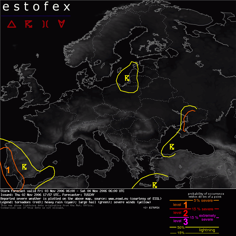
A well developed LL depression is forecast to evolve north of the Black Sea, moving rapidly towards the North, while a broad upper-level low should continue to affect parts of Portugal and Spain.
DISCUSSION
...Portugal and SW Spain...
Broad upper-level trough will continue to stall between the Azores and Portugal.... Same procedure at lower levels with an SW-NE elongated LL depression west of Portugal....
An interesting note is that GFS and UKMET both see a shallow warm core evolution with this system, which would support an increase in convection around the center, but latest IR images and model outputs do not look excessively supportive for any significant ( possible subtropical )development.
Main concern for scattered TSTM activity continues to be along the belt of rich subtropical moisture, stretching all the way up to Portugal and SW Spain.... 12Z sounding of Lisboa ( 02.11.) already showed nice veering at low levels and some slight cooling during the next 12 hours at the mid-levels should support slightly steeper mid-level lapse rates and hence more robust instability values.
A slightly enhanced tornado risk exists mainly in the level-1 area due to low LCLs and some veering, but main threat should be an excessive rain risk due to very high PWAT values and slow storm motion.
Estofex lo está clavando... tormentas intensas por Huelva


 Tema: Seguimiento de tormentas Noviembre 2006. Localizacion, evolucion... (Leído 19944 veces)