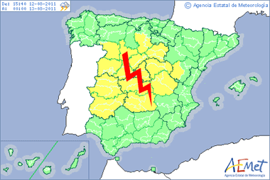
Mapa de alertas por lluvias y tormentas previsto por AEMET hasta las 00 horas de mañana sábado.
12.08.11. Tal como avisábamos hace hoy tres días, las tormentas han regresado a la Península Ibérica, haciendo que numerosas provincias de todo el interior estén en alerta amarilla por este fenómeno.
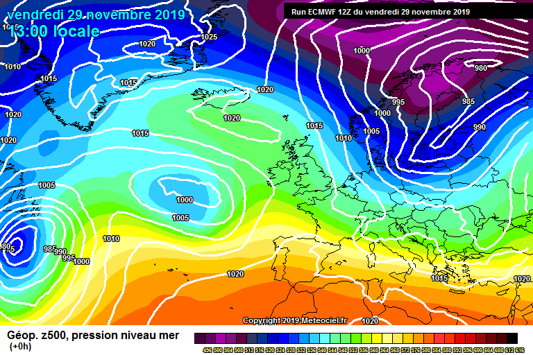
El origen de esta inestabilidad lo encontramos en un pequeño embolsamiento de aire frío en altura que se refleja en los mapas de altura geopotencial a 500 hPa como una depresión aislada; es decir, una DANA de libro. También es muy sencillo descubrirla si cargamos las últimas imágenes en modo vapor de agua (water vapour / WV).
En su avance por nuestro territorio, está provocando un aumento notable de la inestabilidad atmosférica, favoreciendo el crecimiento vertical de las nubes y dando lugar finalmente a tormentas que durante lo que queda de tarde pueden ser de bastante intensidad en las zonas que se encuentran con alertas activas.
El equipo del European Storm Forecast Experiment también se hace eco de esa posibilidad de tormentas severas en el interior peninsular. Esta es su discusión al respecto, en inglés:
…Portugal and Spain …
A weakening upper low is embedded in ongoing split-flow regime. Overall tendency for this feature is to merge with a modest deep layer jet to its north, which causes this low to move more to the east, while opening up.
Strongest height gradients / shear remains confined to the southern fringe of this feature, covering all of far S-Spain and adjacent areas. However, with a track forecast over far S-Spain, strong WAA advects a dry and hot air mass northwards, probably capping most of the area with strongest shear over far S-Spain (DLS up to 20 m/s). Hence, initiation is confined to areas further north, including all of central and parts of northern Spain, where scattered initiation is expected…probably more isolated further south.
Advection of a well mixed and dry African air mass to the forecast area results in steep mid-level lapse rates. BL moisture is not impressive at all with surface dewpoints in lower to mid tens, but that’s adequate for 500 – 1000 J/kg MLCAPE. Where pockets of better moisture exists (e.g. along mesoscale convergence zones), those values may be exceeded. As upper trough moves in, wind field veers with increasing SRH forecast. Therefore, multicells are well possible with isolated supercells not ruled out, given 10 to 15 m/s DLS ( with highest supercells risk probably in the low thunderstorm probability area over southern Spain, where DLS increases to 15-20 m/s). Large to very large hail is forecast, next to severe downbursts, given well mixed and deep subcloud layer with augmented DCAPE. For now we think a broad level 1 may cover that risk despite the fact that a few significant hail events are well possible. However uncertainties in mesoscale evolution of surface flow pattern (e.g. placement of convergence zones) preclude a level 2 for now. Storms keep going all night long while spreading to the northeast.
Puedes seguir todas estas tormentas desde nuestra sección de satélites, así como en los distintos radares de rayos disponibles.
En el foro de debate de este portal ya se está haciendo seguimiento activo de dichas tormentas. Puedes registrarte y participar con los demás foreros, aportando tus datos, fotos y/o vídeos. También puedes enviar reportes de tiempo severo a la Base de Datos Europea de Fenómenos Severos. Y si te haces fan de nuestro muro en facebook, te será más fácil estar al tanto de nuestras últimas noticias, así como para compartir tus fotos.


Tú opinas