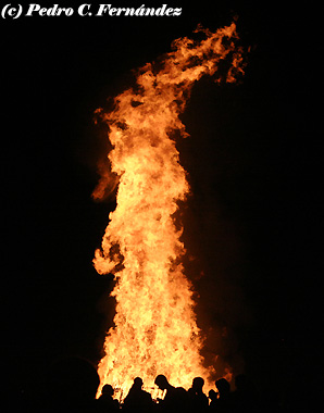
Bonfire of Saint John in Salobreña, 2010.
22.06.11. One of the most important nights of all the year in Spain is coming…! San Juan’s night, which is full of bonfires, fireworks and feast! In this is the main reason by what the weather forecast is so important in this case. Then, lets go with the details!
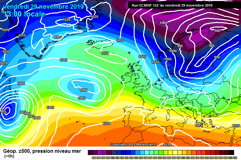
Synopsis: the summer began last Tuesday, and typical summertime weather is expected for the Midsummer Night’s Eve and the next weekend. In this way, a pronounced warm advection from the north of Africa will affect to the entire Iberian Peninsula by Saturday and Sunday. A deep Atlantic trough will take responsibility in that very warm advection, stimulating its genesis. In the other hand, we could feel some eastern winds and some cloudiness in the sky, typical of this time of year. Details:
Tomorrow: few clouds or no clouds in the sky during all the day. Wind will blow weakly from N early in the morning, especially along the coastal – line and along the main valleys of our region (land nocturnal breeze). With the pass of time and the land warming up, wind will turn to WSW and SW (sea diurnal breeze), weak in general.
TEMPERATURE IN SALOBREÑA: MIN.: 20ºC – MAX.: 25ºC
Sea surface temperature (coastal waters): 22ºC
Friday: some low clouds banks (stratocumulus) could arrive to the Costa Tropical in the morning, being swept by an east-southeastern wind flux that will stablish along the Alboran Sea. If the low clouds appear, they will not stay for a long time, dissipating quickly with the pass of time. Wind will blow from N and NE early in the morning. It will tend to turn to ESE and SE since midday, with moderate gusts, especially along the coastal – line. It will tend to abate at night.
TEMPERATURE IN SALOBREÑA: MIN.: 20ºC – MAX.: 25ºC.
Sea surface temperature (coastal waters): 23ºC
Saturday: weather conditions will be almost the same than Friday, with a chance of low clouds banks in the morning which should dissipate with the pass of time. Wind will blow weakly from N and NE at first hours, turning to ESE and SE since midday. By then, it could blow hardly over some coastal locations, like Carchuna, for example. It will tend to abate at night.
TEMPERATURE IN SALOBREÑA: MIN.: 21ºC – MAX.: 26ºC.
Sea surface temperature (coastal waters): 23ºC
Sunday: with some degree of uncertainty, some little changes are forecasted. In this way, it is probably the low clouds banks will not appear but, in its place, high & medium level clouds (cirrus, cirrostratus, altostratus…) could reach the Costa Tropical. Wind will blow weakly from N and NE early in the morning, especially along the coastal-line & the main valleys. It will tend to turn to SE with the pass of time, blowing with some moderate gusts. Temperature will still rising up due to a very pronounced warm advection coming from the north of Africa. That advection will be stimulated by a deep Atlantic trough forming over Azores. Hot will be a very commented new on TV and newspapers.
TEMPERATURE IN SALOBREÑA: MIN.: 22ºC – MAX.: 27C.
Sea surface temperature (coastal waters): 24ºC
Don’t forget to take a look to the page on Facebook for the last updated data. You can leave there your comments and photographs if you want it.
![]()
Non-official weather forecast developed by Pedro C. Fernández. Based on several weather runs outputs. The Weather Station of Salobreña – Beah, provides its data online on Internet: www.cazatormentas.net/salobrena.html It is sponsored by “Freiduría ‘El Rey del Boquerón’” Restaurant, Hostal Palomares ** (www.hostalpalomares.com), “El Forajido” Restaurant (www.restauranteelforajido.com), Seafood/Shellfish Restaurant «El Trasmallo», the Patisserie/Ice-Cream parlor “Delicias del Rey Fernando”, the exclusive Clothing Store BOHEMIA, and Mª José Parapharmacy (in front of the Mercado Municipal), all business of Salobreña.
The copy of this weather forecast is forbidden.


Tú opinas